TerraModus Surveying
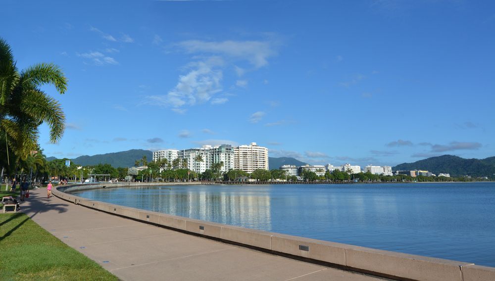
Expert Surveying in Cairns
- Trusted by property owners, developers, builders, architects and local councils.
- Serving Far North Queensland, including remote areas.
- Reliable data for boundary identification, property development and construction.
Established in 2007
Industry Leading Expertise
Efficient Project Delivery
Locally Owned & Operated
Your Local Surveying Professionals
TerraModus Surveying provides professional, reliable, and high-quality land surveying services across Far North Queensland. Serving the Cairns region, the Atherton Tablelands, the Cassowary Coast, the Douglas Shire, Cape York, and beyond, we are dedicated to delivering precise surveys in a timely manner with no hidden fees. Our services include cadastral and engineering surveys, from boundary identification and subdivisions to detailed site mapping. “TerraModus” means “earth measurement,” and that’s exactly what we deliver with each project.
We work closely with developers, homeowners, councils, and local businesses such as designers and builders to provide detailed, dependable data that supports planning and property management. We’ve built a reputation on our quality surveys, and our experience and proficiency is what makes all the difference. Whether you’re developing land, clarifying existing property boundaries, or managing a complex project, TerraModus Surveying has you covered for all your surveying needs.
For professional surveying in Cairns and throughout Far North Queensland, please complete our enquiry form to discuss your project requirements and get expert advice from a team that cares.
What We Do
We specialise in cadastral surveys to accurately define property boundaries, perform subdivisions, define easements and leases as well as strata titling. From residential lots to larger commercial areas, our surveying services ensure clear, compliant land measurements for seamless property development, reconfiguration, and boundary identification. We provide the accuracy and certainty of property boundaries you are looking for.
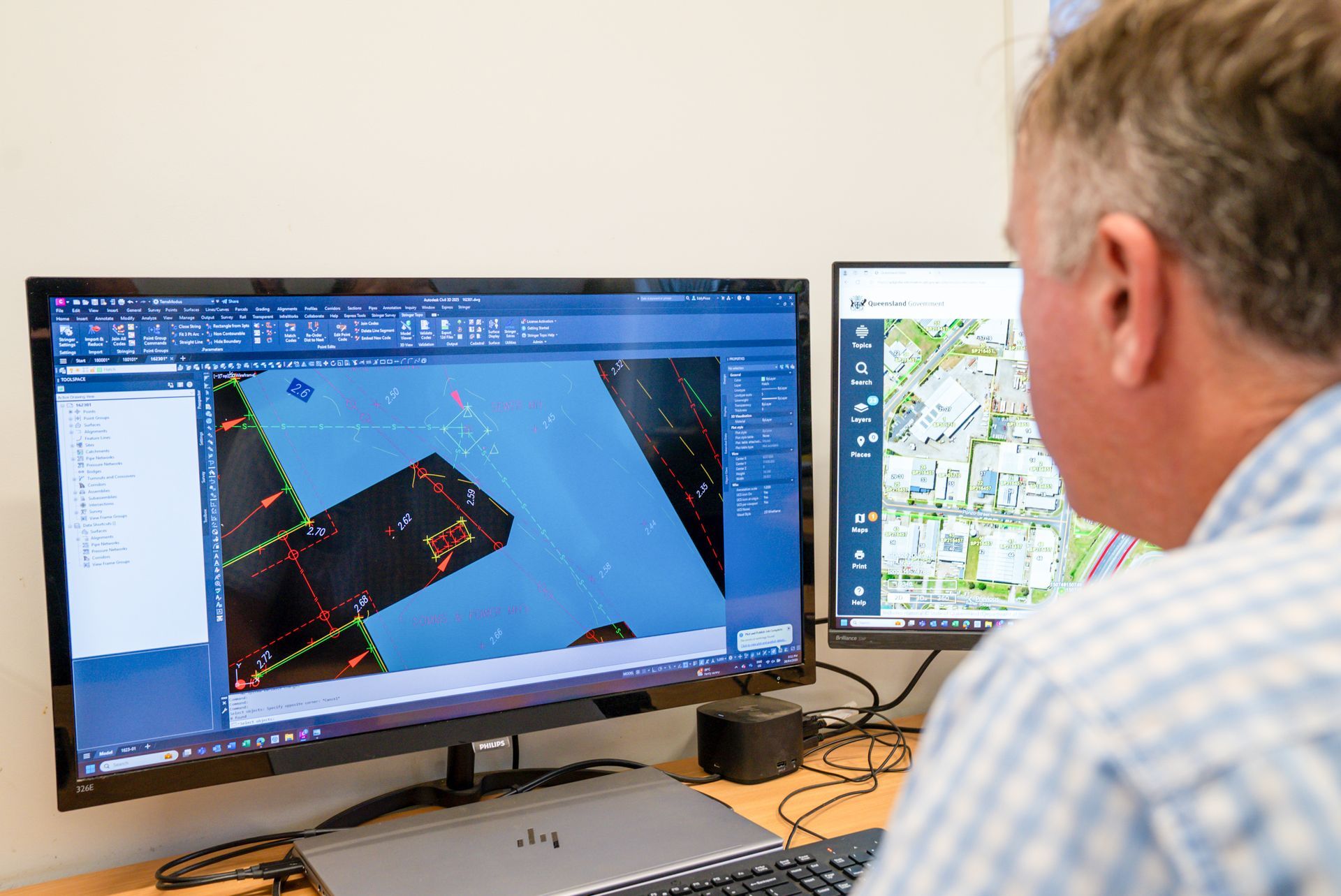
Our engineering surveys provide essential data for construction and planning. We handle contour and detail mapping, AHD levels, building set-outs, and as-constructed surveys, delivering insights to support project goals and certification across diverse sites and environments.
Reliable Surveys, Trusted Results
Why Choose Us?
Choose TerraModus Surveying for expertise, reliability, excellence, and a client-focused approach to all surveying needs. As a family-owned business, we’re committed to quality service with a local touch, making us the trusted choice across Far North Queensland. We offer:
- Registered surveyors with deep local knowledge and survey expertise.
- Comprehensive cadastral and engineering surveys.
- Technical excellence meeting all legislative and regulatory compliance
- A wide service area. We service all of FNQ - from Cairns to Cardwell to Mareeba and Mossman, Cooktown and Cape York.
- Friendly, professional and attentive service tailored to meet your every project need.
- Proven track record with a reputation of delivering professional, detailed and timely solutions.
- Fully qualified and insured so you can rest assured you are covered.
- Realistic and honest timeframes with no hidden fees in our quotes.
For dependable surveying services across Cairns and Far North Queensland, call TerraModus Surveying on (07) 4054 4072 or complete our enquiry form. Let us help make your next project a success with accurate, trustworthy survey data.
Frequently Asked Questions
Why do I need a Registered Cadastral Surveyor?
A Registered Surveyor is someone who has been assessed as having the correct qualifications and being competent to perform surveys by the Surveyors Board of Queensland. Surveys performed by Registered Surveyors are carried out in a professional, competent manner meeting the appropriate current legislation, standards and guidelines. Registered Surveyors with a Consulting Endorsement can consult with the public and they have been assessed in business practices and carry the appropriate professional insurances.
Registered Surveyors are required to adhere to a Professional Code of Practice and are also required to demonstrate their competency each year through continual professional development.
Only Cadastral Surveyors can legally place property boundary marks, and when they do they must prepare a survey plan to record those marks.
If you are not receiving a plan for a boundary survey, then you may not be using a Cadastral Surveyor which means you do not know the accuracy or quality of the survey work. It also means that the person is unlikely to be insured for land boundary work. By having a survey plan you have the evidence of the boundary survey and you are protected.
By using a Registered Surveyor you know they have been assessed by the Surveyors Board of Queensland as being competent in their area of expertise. You may have been told you need a Licensed Surveyor - this term is no longer current in Queensland. The correct term, by legislation, is a Registered Cadastral Surveyor or a Consulting Cadastral Surveyor but these qualifications are the same as the old term Licensed Surveyor.
The term Registered was introduced to also recognise the other surveying specialties such as Engineering, Mining and Hydrographic. Land Surveyors or Cadastral Surveyors are still the most commonly Registered Surveyor.
TerraModus Surveying is a Consulting Cadastral Surveyor and carries all the appropriate insurances (including professional indemnity and public liability) to perform cadastral (land boundary) surveys.
What type of survey do I need?
We do not expect you to know what type of survey you require. You can refer to our Cadastral Surveys or Engineering Surveys pages, but if you can let us know what you are trying to achieve and why you want a survey performed, we will be happy to assist you with all your survey requirements. The more information you can provide, including property details, maps and approvals will assist us to fulfill all your survey needs.
There are many types of surveys including cadastral surveys (such as subdivisions, boundary identification surveys, leases and easement surveys), engineering surveys (such as contour and detail surveys) and construction surveys (such as building set-out). Sometimes you will require multiple surveys to achieve your goal, such as a contour and detail survey to locate the features of your property for the design of your new house, and a boundary identification survey to ensure the house is constructed correctly on your property.
TerraModus Surveying is well qualified and experienced to perform all types of surveys.
Why do I need a Form 12 Certification for my property?
Your builder, certifier or council may request certification that any building work has been constructed within your property when any structures are on or near a property boundary. As Cadastral Surveyors are legally the ones who define boundaries, in many instances you will require construction set-out to be perform by a Registered Cadastral Surveyor. The Surveyors Board of Queensland have created a guideline about property boundaries which states:
If a certification is required regarding the location of any building, improvement, or utility in relation to a property boundary, this must be provided by a Registered Cadastral Surveyor. This includes a Form 12 certification in relation to boundary clearances of a building per s18 of the Building Regulations 2006 relating to the Building Act 1975.
Ensure you use a Registered Consulting Cadastral Surveyor! This ensures the job is performed professionally and the work is insured. Surveying Associates or Surveying Graduates are not Registered Surveyors and cannot perform boundary related surveys unless they are under the supervision of a Cadastral Surveyor taking responsibility for the survey.
You can check any surveyors’ registration status with the Surveyors Board of Queensland.
Where should I build my fence?
Fences are usually built on the boundary.
To find out exactly where your boundary is you should engage a Consulting Cadastral Surveyor to perform a boundary identification survey. A cadastral surveyor will identify your boundaries, place survey marks at the corners and prepare an identification survey plan as a record of the survey.
The Neighbourhood Disputes Resolution Act 2011 provides an avenue for you and your neighbour to share the costs of building a fence, which includes sharing the cost of a boundary identification survey so the fence can be built on the common boundary. This Act relates to constructing and repairing fences that divide adjoining freehold land, and generally under this legislation owners of adjoining land not separated by an adequate fence can be liable to contribute equally to the cost of a dividing fence. For further details you should refer to the Housing and Neighbours section on the Queensland Government website or contact a solicitor.
In our experience if you build a fence and it is not on the boundary it will often cause disputes in the future. Further if the fence encroaches onto your neighbour’s lot you may be required to remove it and be liable to contribute to the costs of a new fence on the boundary. While a boundary survey may seem expensive it is worth knowing you have built the fence correctly on your boundary and it is an investment in your property. Your house is often your most valuable asset so it is worth the money to protect your asset and know exactly where your boundaries are - whether the fences are correct, whether the tree is in your property, where you can build your shed etc.
Neighbourhood disputes can be stressful and costly. Only Cadastral Surveyors can legally determine where boundary corners are and assist in resolving boundary disputes. We highly recommend having a boundary identification survey performed prior to erecting a fence.
Can you provide coordinates for my property boundaries?
In a simple answer, No.
In Queensland, property boundaries are not defined by coordinates or GPS points. The Queensland titling system is based on the Torrens system, which provides certainty of title to land. The Torrens System ensures that a person purchasing land is able to acquire a secure title to that land in a process that facilitates timely and effective land dealings. Under the Torrens Titling system certificate of titles describe land referencing survey plans. Survey plans do not contain coordinates for property corners. Survey plans define property boundaries by a series of lines of bearings and distances measured by a surveyor with a list of marks that has been placed at each of the boundary corners (usually white pegs).
A surveyor’s job is to define and/or redefine the land boundaries using the best available evidence for establishing the intention of the parties at the time the boundaries were created and the greatest weight must always be given to lines and corners as marked on the ground.
Therefore, it is the survey marks that define your property boundaries, not coordinates.
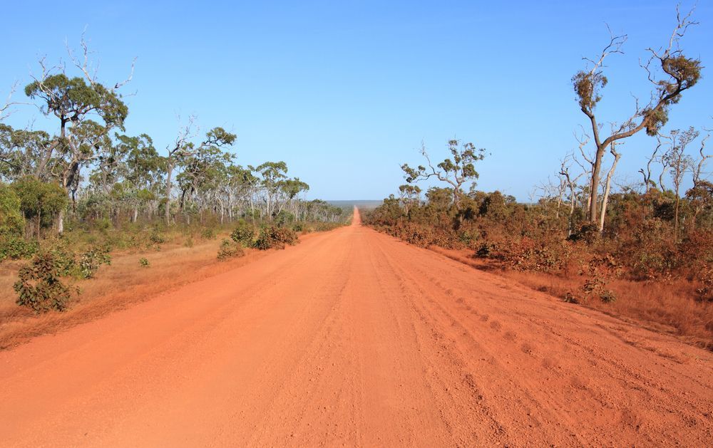
Many maps are produced that show coordinates on them. Sometimes the property boundaries are plotted or overlaid onto these maps. These maps merely provide a representation of where the boundaries might be and are approximate only. It is also important to note that handheld Global Positioning System (GPS) coordinates are not accurate in terms of repeatability and reliability (usually +-5m). In urban areas this means by using approximate coordinates and a handheld GPS you could be on your neighbour's lot! If you live on a rural property, sometimes approximate GPS coordinates from a map overlay may assist you in locating any visible survey marks (e.g. pegs or survey reference trees) at your boundary corners. Please keep in mind that TerraModus Surveying have performed rural surveys where the boundary overlay on maps were hundreds of metres out of position. It is common for rural fences to be built where it is easiest to build a fence for livestock and therefore fences in rural areas are often “working fences” and not “boundary fences”.
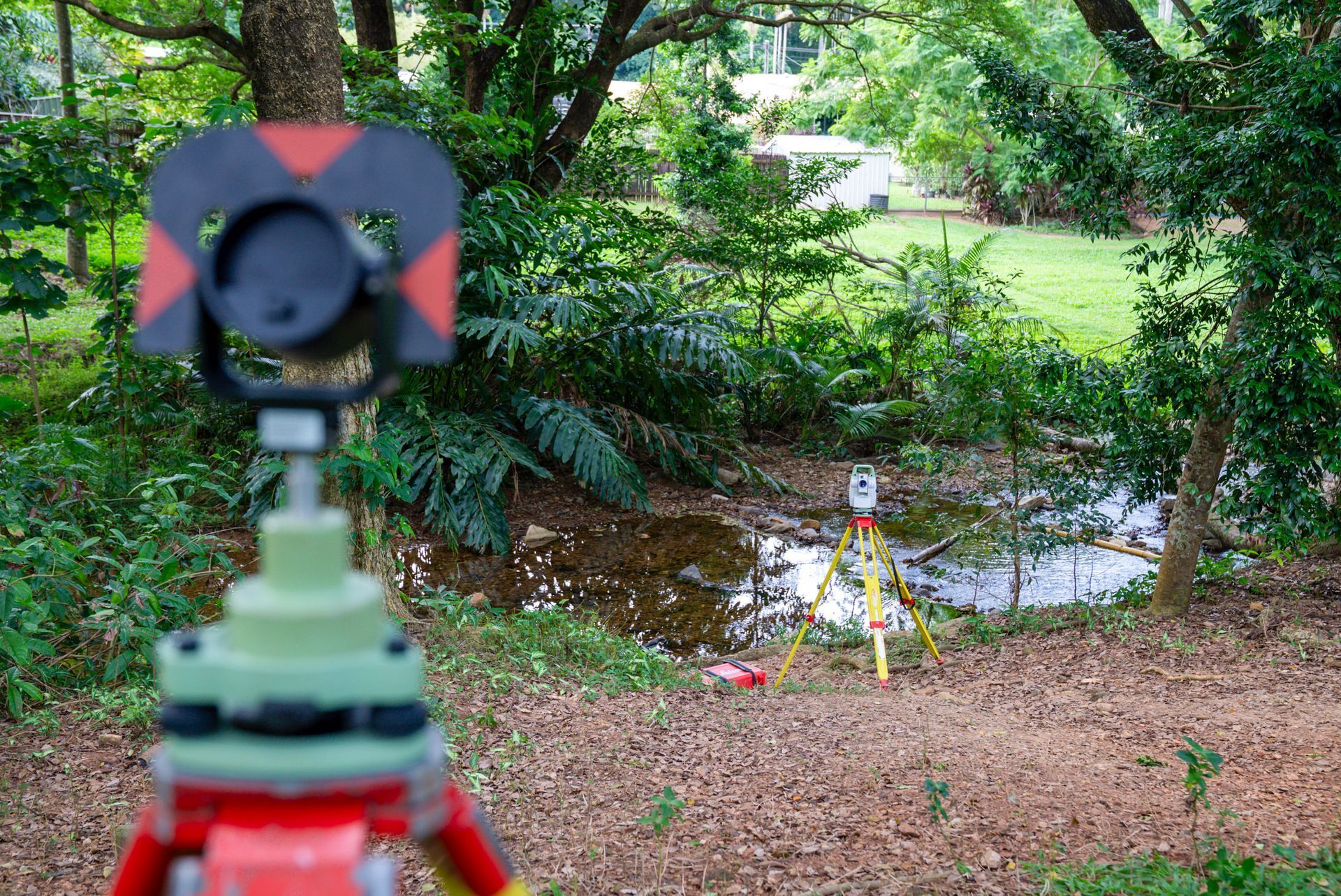
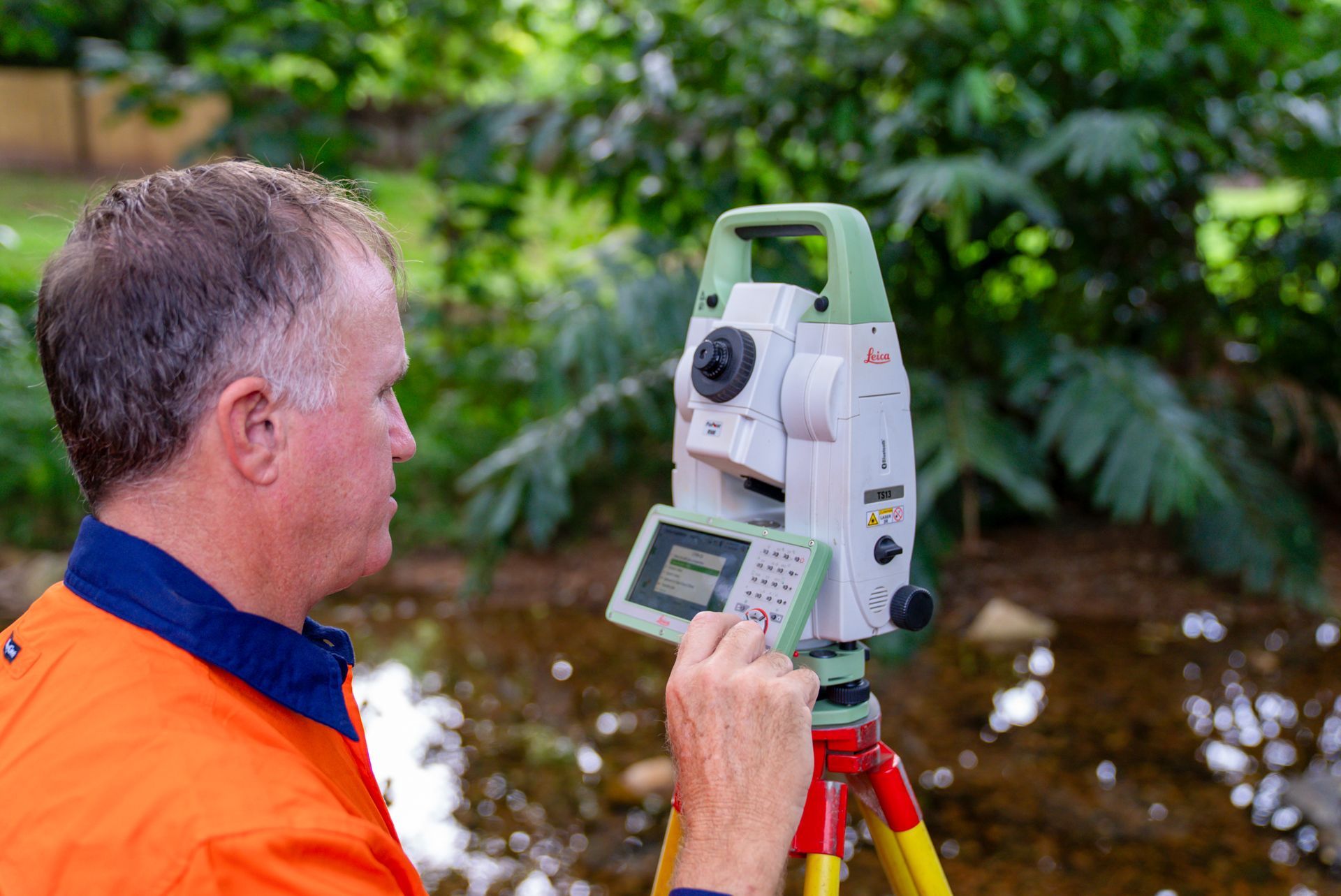
You may see surveyors use survey-grade GPS (millimetre accuracy with reliability). We use Global Navigation Satellite Systems (GNSS) which are multi-constellation satellites of which the USA's GPS system is the most well-known. Survey-grade GNSS is a great tool to assist surveyors in their jobs but for most urban cadastral surveys GNSS is not suitable for land boundary measurements, which is why you see surveyors using total stations to accurately measure bearings (angles) and distances.
TerraModus Surveying are experts at defining boundaries and re-marking property corners. If you need to know where your property boundaries are please contact us for a boundary identification survey.
We pride ourselves in providing honest and realistic timeframes for both the field survey and plan preparation. Please contact us early if you have specific time frames you are working towards.
How much will a survey cost?
We do not have a standard fee for performing a survey as no two surveys are alike. The cost of the survey depends on many factors like the type of survey being performed, location of survey, size of parcel, previous survey work performed in the area, age of previous surveys, availability of existing survey marks and type of vegetation on the parcel. These factors determine how long a survey will take which will influence the cost of the survey.
Surveying fees are not simply about the field work - costs include government searches, materials, office calculations, travel, plan drafting, administrative asks etc. This is the part many people do not see or understand. Government searches required to perform boundary surveys are often hundreds of dollars before any pre-field calculations, field survey or plan drafting is undertaken. Accommodation and meals (if required) are charged at cost and therefore keeping your costs to a minimum.
To give you an indication of price, an Australian Height Datum (AHD) height survey to establish a Temporary Bench Mark (TBM) on site usually starts at around $1000 +GST. Whereas a boundary identification survey including project management, field survey and plan preparation usually starts at around $2000 +GST for a suburban lot in a new estate in Cairns.
With your property most likely your largest asset, having your boundaries surveyed is a small cost in protecting your investment, building within your property, utilising all the land you pay rates and avoiding neighbourhood angst by knowing where your boundaries are.
TerraModus Surveying is happy to provide a free, no obligation quote for your survey requirements. Just contact us!
How long will the survey take?
Each survey is different. To give you an idea, a boundary identification survey on a standard residential lot in Cairns can usually be performed in the field in one day and the entire survey service including preparation, obtaining government searches, field survey, plan drafting and quality assurance may take only one to two weeks. Whereas a rural subdivision in heavily vegetated country may take several days or even weeks in the field and several days or weeks in survey preparation, searches, plan drafting and quality assurance.
When can the survey be performed?
When the survey can be performed will depend on our existing commitments and workloads. We aim to perform the survey to meet your time frames and needs. The more notice you can give, the more likely we can fit in with your dates.
We schedule work once we receive written authorisation to proceed. Sometimes we can fit smaller works in between larger jobs so if you are lucky the survey may able to be performed within a week or two of being engaged but our usual lead time about 3-4 weeks. Occasionally, during peak times our lead time to perform surveys may even be longer.
Please note even if we have capacity at short notice we need at least 48 hours’ notice to prepare for a survey - obtaining government searches for the job and doing pre-field calculations.
What access do you require for the survey?
For most surveys, such as boundary identification surveys, we only require access to the yard, and therefore you do not need to be home while the survey is being undertaken. We will require gates to be unlocked, and while we love dogs, dogs should be restrained while we work within your yard. For strata title surveys and building lease surveys, we do require access to the house/building to measure the internal dimensions. For these surveys we can coordinate a suitable time for you and/or your tenants to ensure the survey is performed with appropriate notice and on a day when access can be provided.
How do I read my survey plan?
Your survey plan has been prepared by TerraModus Surveying in accordance with the current surveying legislation, standards and guidelines including the Surveying and Mapping Infrastructure Act 2003 and Queensland’s Cadastral Survey Requirements. The plan displays the purpose of the survey and the intended actions of the lot/s of land, such as a land subdivision. The plan is a legal document representing the field survey performed and administrative details associated with the parcel of land.
The terminology and abbreviations used can make survey plans difficult to interpret. Keep in mind each jurisdiction (state, territory, country) will have different survey plan requirements under their legislation and therefore the terminology will differ too.
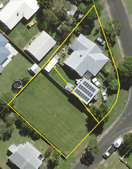
A survey plan (SP barcode) shows the boundaries of the lot/s and other titling interests (such as easements) in the form of bearings and distances for the subject land. Distances are represented in metres. An area will also be displayed for each subject lot or interest on the survey plan. The bold lines represent the subject lot/s being surveyed and the other lines show the extent of the survey and adjoining information. Adjoining information to your lot/s, including lot on plan descriptions and street names, as well as the locality and local government is shown on the survey plan to clearly identify where the parcel lies in Queensland. All this information is critical to the plan and the titling system. Here at TerraModus Surveying we have exceptional quality assurance checks to ensure your plan is correctly represented.
What does the survey plan (SP) show?
A survey plan shows the boundaries of the lot/s and other titling interests (such as easements) in the form of bearings and distances for the subject land. Distances are represented in metres. An area will also be displayed for each subject lot or interest. The bold lines represent the subject lot/s being surveyed and the other lines show the extent of the survey and adjoining information. Adjoining information to your lot/s, including lot on plan descriptions and street names, as well as the locality and local government is shown on the survey plan to clearly identify where the parcel lies in Queensland.
I have a copy of an old survey plan but the distances seem incorrect?
In Queensland, most pre-metric survey plans represent distances in links. Since 1973, distances on survey plans have been shown in metres. Therefore, it is unlikely that the distances on the old survey plan are incorrect; it is more likely they are represented in imperial measurements and need to be converted to metric.
Where do we perform surveys?
TerraModus Surveying is based in Cairns but performs surveys throughout Far North Queensland. We perform all types of surveys in urban, rural and remote areas. We are happy to travel to the job. We perform surveys throughout FNQ from Ingham to the Torres Strait to the Gulf including the Cairns Region, Atherton Tablelands & Mareeba Shire, Innisfail & Cassowary Coast, Mossman & Douglas Shire and Cooktown and Cape York. We understand the unique challenges of performing surveys in the various areas of FNQ.
Where are the survey marks shown on the plan?
As per survey legislation and standards, TerraModus Surveying places recognisable survey marks, usually white survey pegs, at each subject property corner unless it is physically impractical to do so. These survey marks are displayed on the survey plan at each corner or by a statement noted on the plan. An example of such a statement is “Peg placed at all new corners”. A finder stake is usually placed next to the white pegs in the ground to help you find the corner pegs.
Original survey marks (i.e. recorded on a previous survey plan in Queensland’s survey plan archive) are noted on the plan with the abbreviation “O”. For example OP is an original peg and OIP is an original iron pin. Permanent Marks and Reference Marks are placed by surveyors to facilitate future surveys, and this information is used by surveyors and available by obtaining survey searches from the Queensland Government. Permanent Marks and Reference Marks are usually tabulated on the survey plan. These reference marks are placed near the corner (not at the corner). Please do not disturb these marks as if disturbed it will affect the time it will take to perform future surveys which can be costly to you, your neighbours and future landowners in the area. It is also an offence under the Survey and Mapping Infrastructure Act 2003 to interfere with survey marks without approval.
Common reference marks used are Iron Pins, Nails, Drill Holes, and in rural areas blazed trees. Existing fencing is known as occupation and is usually shown as a way of reference to the corner. TerraModus Surveying can show you the boundary marks placed as part of the survey, and we are happy to provide our clients an information sheet with your survey plan to assist you to interpret the survey information shown on the plan.
You can read further information about survey marks on the Queensland Government website.
Where do I lodge my plan?
Titles Queensland manages the land and water title registries for the state of Queensland. Survey plans (SP Barcoded plans) need to be lodged with Titles Queensland. For many title transactions, there is an increasing ability to lodge electronically, as outlined by Titles Queensland.
For freehold survey plans (SPs) you need to lodge the survey plan with associated documents and pay the appropriate lodgement fee. Lodgement fee calculators are available on the Titles Queensland website. The survey plan will nearly always be accompanied by other documents and forms, depending on the proposed plan actions. The survey plan is usually accompanied by forms for owners’ approval and council endorsement (Form 18A and Form 18B) and a plan cover sheet (Form 21Z). The survey plan must be lodged within 6 months of the council endorsement date. Many of our clients arrange for their solicitor to lodge the plan and documents electronically on their behalf.
For survey plans (SPs) involving state land you should forward the original survey plan to the Land Officer in the Queensland Government responsible for your case (as per your letter of offer from the government) who will lodge the survey plan and associated forms and documents with Titles Queensland on your behalf.
Identification survey plans (IS barcoded plans) are deposited into the Queensland Government survey archives by TerraModus Surveying on your behalf. There is no fee to lodge these plans as they form part of the government survey plan archive and there is no transaction into the Titles Registry. Identification survey plans are a public record of the survey performed and the marks placed. You are provided with a copy of the identification survey plan, and it is this boundary identification survey plan that confirms your survey has performed by an insured, qualified professional cadastral surveyor. It is a legal requirement when undertaking a survey relating to boundaries to produce an identification survey plan and deposit it with the government. Only Registered Cadastral Surveyors can undertake cadastral surveys and produce these survey plans.